

0800 644 6117
Drone Surveys
Welcome to Mach Abseiling – Elevating Precision with Drone Surveys
At Mach Abseiling, we specialize in providing innovative and efficient solutions for your surveying needs through cutting-edge drone technology. Our team combines industry-leading abseiling techniques with the latest in drone surveying to deliver unparalleled precision and insight, all while ensuring safety, speed, and cost-effectiveness.
Whether it's assessing hard-to-reach structures, monitoring construction progress, or conducting environmental surveys, our drones offer a detailed aerial perspective that traditional methods simply can't match. With a commitment to quality and customer satisfaction, Mach Abseiling is your trusted partner in gathering accurate, real-time data that supports informed decision-making for a wide range of industries.Discover the future of surveying with Mach Abseiling – where high-tech meets high-altitude.


Commercial Roof Surveys
Our commercial roof drone surveys offer a fast, efficient, and cost-effective way to assess the condition of your building's roof. By utilizing advanced drone technology, we provide high-resolution aerial images and detailed inspections without the need for costly scaffolding

Land Surveys
Our land survey drone services provide precise, reliable, and efficient mapping and surveying solutions for a wide range of applications. Using advanced drone technology, we capture high-resolution aerial imagery and topographic data, offering detailed and accurate insights for land development, construction projects

Domestic Surveys
Our domestic drone survey services provide homeowners and property managers with efficient, cost-effective, and non-invasive solutions for property inspections, land assessments, and aerial photography. Using advanced drone technology, we deliver high-resolution images and detailed data to assess roofs, gardens, and hard-to-reach areas, helping you identify potential issues early on
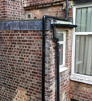
Drainage/Damage surveys
Our drone surveys for building damage assessments provide a quick, safe, and highly accurate way to evaluate structural damage without the need for scaffolding or ladders. Using cutting-edge drone technology, we capture high-resolution images and detailed footage of the affected areas, offering a comprehensive view of the damage to roofs, facades, and other hard-to-reach parts of the building.
Get a Quote
Contact us for a free quotation or to discuss your project.